Tuesday's postcard, and a visit to the "Hoh Formation"
July 30, 2024
“Time in a cradle” —a ~billion year-old slab from the ancient Belt Basin in a cradle of ~15 million year old basalt in the Spokane River.
Of Geology, and Photography
On its way east from Portland to Spokane the Empire Builder makes four stops, the first of which is in Vancouver, WA. There a woman from Sandpoint, Idaho—as fresh from a visit with her daughter as I was fresh from a visit with mine—stepped aboard and asked if she could sit in the aisle seat next to me. Of course, I said.
Upon learning she lived in Sandpoint, I instantly began thanking her for her rocks. I’m odd that way, I suppose. But I thought it was funny and—as she surely wondered what she’d gotten herself into—I explained that the beautiful rocks in my swimming hole, in Spokane, had come through Sandpoint on their way to the Spokane River, where I fell in love with them. This is what can happen when you ask to sit next to me. In fairness, we also talked about our daughters.
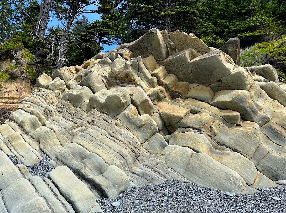
Tilted layers of marine sandstone at Beach #4, Olympia National Park
I’m not a real geologist. I come to geology largely through my photography. If I manage to get a good picture of rock, or a tree, or a bird, it’s just all the more satisfying to know its story.
The challenge with rocks is there are so many stories and scores of real geologists can have long careers sorting them out. I do better on this side of the Cascades, where I feel like I know my way around and generally understand why the landscape looks the way it appears. In college I learned about Steptoe Butte which I could see, out the windows, from the upper floors of the Holland Library. It is a mountain of Cambrian quartzite buried up to its waist in Miocene lava, with the lava (basalt) covered in Palouse soil (loess). Why it’s named after a colonel who provoked and famously lost the 1858 battle near the butte is perplexing, but at least I understand the terrain.
Generally, Washington geology gets more complicated the further west you go. When I lived, briefly, in Ellensburg I thought the Stuart Range—with the jagged peak of Mt. Stuart visible to the northwest—was part of the Cascades. That may be true geographically, but not geologically—not even close. Whereas the active Cascade volcanoes are roughly a million years old, the jagged peaks of the Mt. Stuart batholith are nearly 100 million years old. Indeed, there’s strong evidence the entirety of the Stuart Range formed near Mexico and slid northward over time to its present location. It’s still hard to get my head around that.
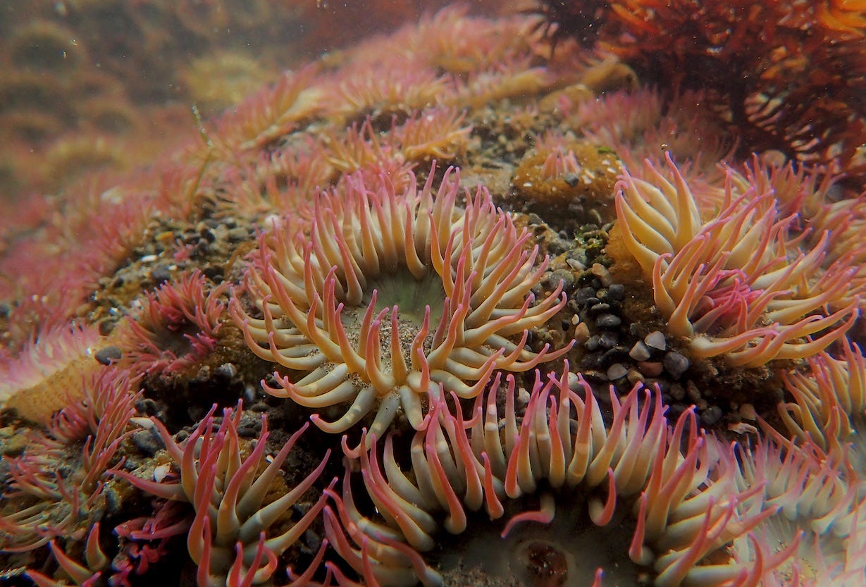
Aggregate anemone in a Ruby Beach tidepool
Generally speaking, the earth story of Washington unfolds in westward- building strips. Nearly all of Spokane County and parts of Whitman and Pend Oreille counties existed some 750 million years ago on the edge of what was then the supercontinent of Rodinia. Beginning about 500 million years ago, successive “terranes” were added as the North American plate headed west and collided with eastward-bound oceanic plates that, every so often, carried land masses. These masses, like pies on a conveyor belt, essentially smushed their ways onto the Washington coast as the incoming oceanic plates were overridden and subducted by the North American plate. The most recently added terrane was Siletzia—thought to have been a large oceanic plateau—that barreled onto the coast some 50 million years ago. Also known as the Crescent Formation, Siletzian rock underlies all of the Olympic peninsula west of Seattle.
The Ocean, and its Mountains
Although no massive terranes have been added since Siletzia, there’s still a lot going at and near the Washington coast as the last remnant of the northeastern-headed Juan de Fuca plate grinds into and then angles downward beneath the North American plate. (I dread to think about it but the geologic record offers compelling evidence that the “megathrust” fault at the so-called Cascadia Subduction Zone causes massive earthquakes every few hundred years, similar to the deadly magnitude 9 temblor—and resulting tsunami—that blasted the Tohoku region in Japan in 2011. But that’s life on Earth, as the dance of creation and destruction involved in plate tectonics helps sustain the planetary biosphere at the same time it rattles the crust and our nerves.)
Weathered sandstone of the Hoh Formation, Beach #3, Olympic National Park
In the meantime—and throughout the past 35 million years—the incessant grinding between the oceanic and continental plates creates beautiful havoc on the seaward edge of the North American plate in Washington state.
East of Seattle and Puget Sound, the friction between the plates inflates balloons of magma in the crust that build and, every so often, erupt from the Cascade range volcanoes (i.e. Mt. St. Helens in 1980). But the Juan de Fuca plate (and before that the Kula and Farrallon plates) also dumps its load so-to-speak. As it dives toward the mantle it deposits a sedimentary medley of sand, mud and marine basalt onto the leading edge of the North American plate.
It’s no small amount. If you climb to the 8,000 foot peak of Mt. Olympus in the Olympic Mountains you will be standing atop a glorious pile of solidified and uplifted marine debris that the Juan de Fuca plate is still delivering to the coast, just forty miles to the west.
Slivers of time at the shoreline
The Olympics are obviously photogenic, but I’m more attracted to the dynamics at the shore. Here, I have to credit Eastern Washington University geologist Chad Pritchard and his co-authors, Gene Kiver and Richard Orndoff, for their 2016 book Washington Rocks! A Guide to Geologic Sites in the Evergreen State. It’s a beautifully illustrated and photographed package that visits and explains (in lay terms) more than 50 locations in Washington, including two of the Olympic beaches where the subduction zone story is vividly playing out. The cover of the book (a striking photograph from Barbara Kiver) captures stunning layers of overturned sandstone at the margin between Olympic Beach #4 and the forest behind it. I just had to go see and photograph that, and have visited it twice, most recently this month
Deformed marine sedimentary layers at Beach #4
To continue reading, please subscribe to The Daily Rhubarb at the link below…


