Thursday's postcard, and an essential, short detour on your way to, or from, Seattle
May 4, 2023
Yellow warbler at a streamside perch in west Spokane
How an obscure freeway exit between Spokane and Seattle can make your day
Halfway across the Evergreen state Interstate-90 dips to the southwest and descends from the open flatlands of Grant County toward the Columbia River. Although Frenchman Coulee is only a mile or so from the freeway it is unmarked and out of view. This may explain why nearly everybody whizzes by one of the region’s premier natural landmarks at 70 miles an hour.
As a promoter of such wonders, a modest purpose of mine is to persuade travelers to explore places like Frenchman Coulee. I accept there is something liberating about the idea of leaving Spokane late in the morning, setting the cruise control, and arriving in Seattle in mid-afternoon. But my cordial argument is that it’s almost silly not to experience Frenchman Coulee (aka Frenchman Springs Coulee) at least once in your lives, and even better to experience it every once in a while.
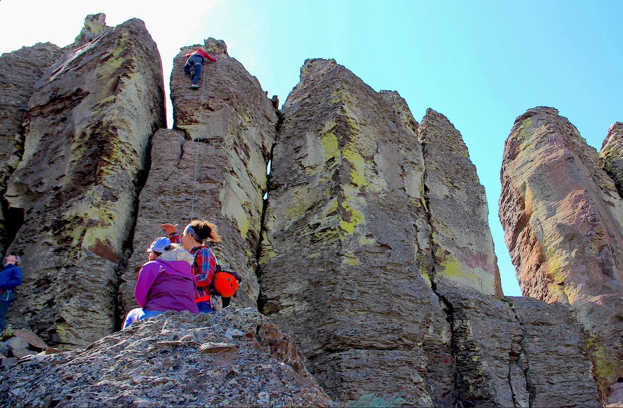
Rock climbers at “The Feathers” in Frenchman Coulee
With that gentle preface, here’s how to get there. Whether you’re headed west or east, the exit for the coulee is Silica Road at milepost 143. Silica Road loops through wetlands for a quarter mile before it intersects with Vantage Road. You’ll want to turn left her, onto Vantage Road, aka the Old Vantage Highway. This can be confusing because—as some of you already know—Vantage is actually on the other side of the Columbia River. So, there is the paradox that Vantage Road will not take you to Vantage. Let’s overlook this, for now, and just make the left turn.
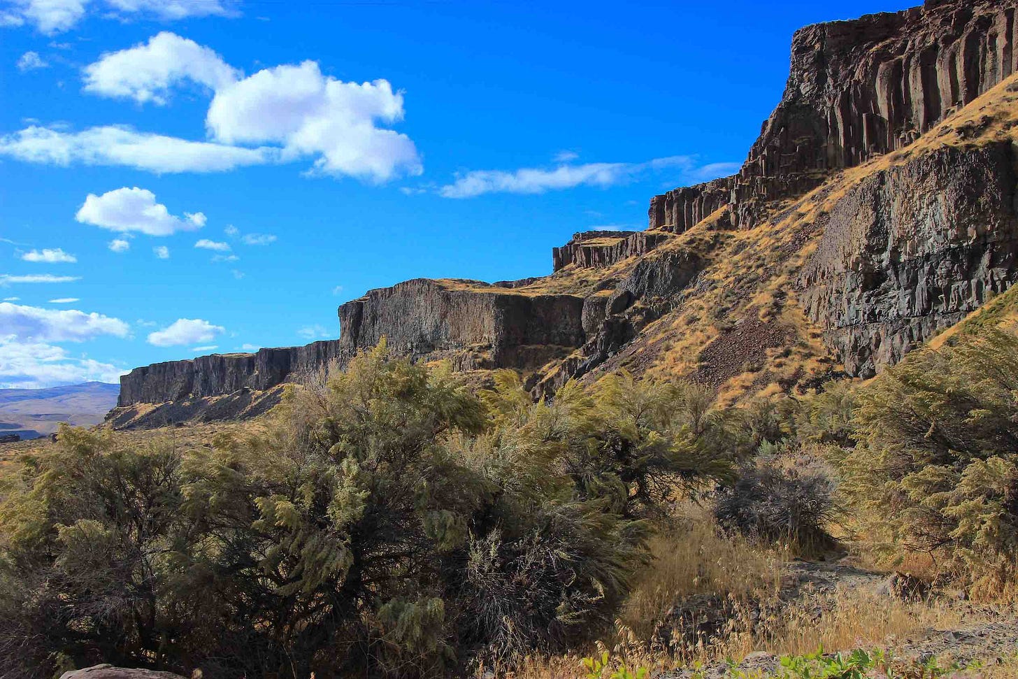
Vantage Road will take you downgrade and, within a minute, a breathtaking scene unfolds. As the pavement descends and bends south, the gaping, northern cataract of the coulee opens to a “V”-shaped chamber, with Vantage Road carved into the left arm of the “V.” The right arm of the “V” is the coulee’s magnificent west wall, complete with a thin white thread of a waterfall spilling from the sheer cliff to a moss-coated talus skirt far below.
West wall at Frenchman Coulee
My cordial argument is that it’s almost silly not to experience Frenchman Coulee at least once in your lives, and even better to experience it every once in a while.
It is startling how abruptly nature takes hold. The ocean of machine-groomed croplands that consume most of the modern Columbia Basin is suddenly out of sight. There are no trophy homes perched atop the rimrock. The cliff-lined river gorge is visible in the distance, and beyond the gorge the Cascade foothills rise west of the river, with the treeless shoulders of Whiskey Dick Mountain on the horizon.
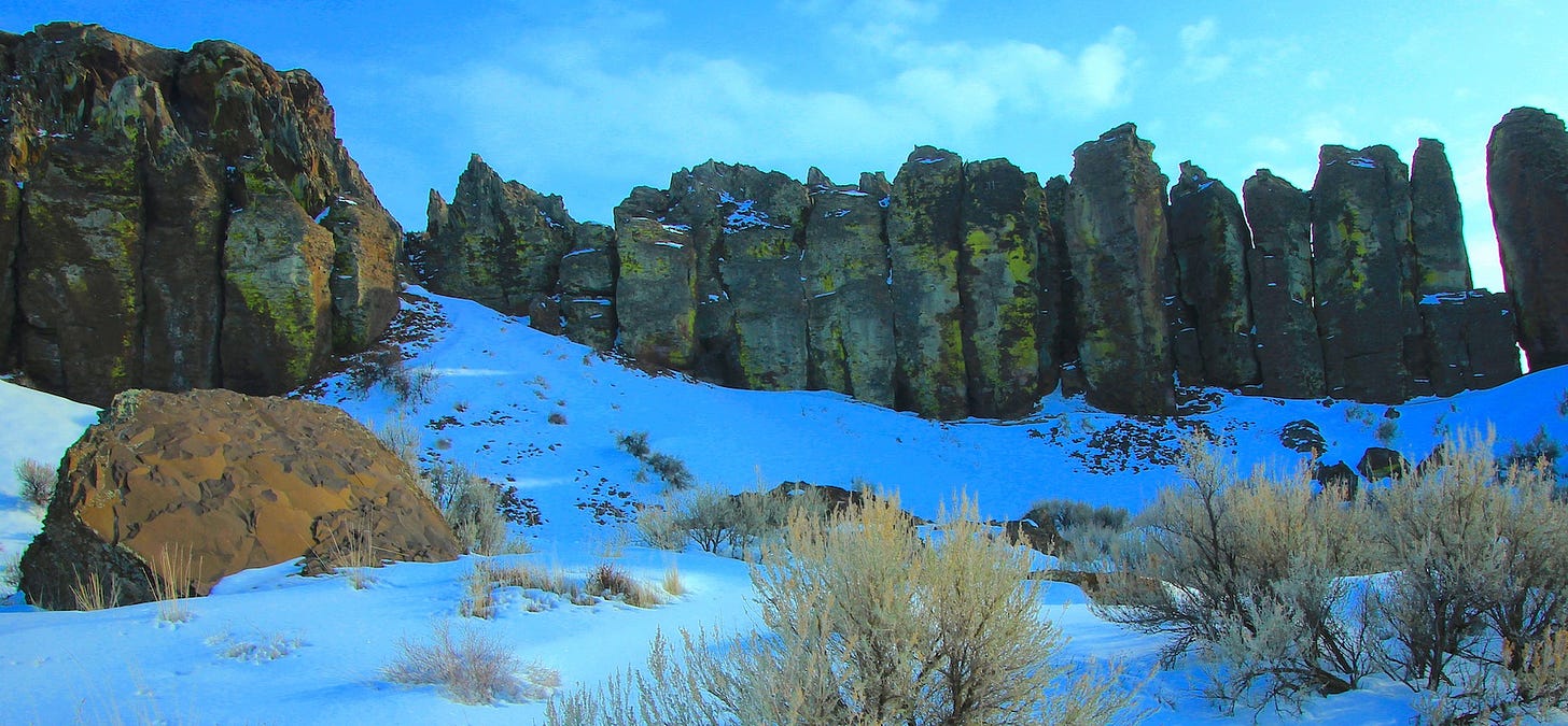
A signature feature within this natural landmark is called “The Feathers” and it will appear, on your left, a mile down Vantage Road. The Feathers are a curved formation of Roza basalt columns—very popular with the region’s rock climbers—that somehow survived the onslaught of Ice Age floodwaters that excavated the coulee. It is a freak of nature that The Feathers exist, as a defiant arc of pillars, some standing taller than forty feet.
The Feathers epitomize what amounts to a rather young (in geologic time) earth story that arrived in two dramatic chapters.
First, from roughly 15 million years ago, came a tide of lava. A portion of those molten outbursts—now catalogued as the Roza member of the Wanapum basalts—emerged from a vent system that extends from east-central Washington to the northeast tip of Oregon. Thus, if you passed through Ritzville earlier in the day, heading west, you can imagine what it must have looked like when a massive, orange and black sheet of molten rock rolled hundreds of square miles from what is now the Palouse all the way to the foothills of the Cascades.
Winter sunlight on The Feathers
Some basalt columns on the Columbia plateau are only as wide as your fist. But the Roza flow features some of the largest columns, and those that form The Feathers have the girth of railroad boxcars. No wonder people want to climb on them.
The second chapter in the Frenchman Coulee earth story has everything to do with the Ice Age floods during the late Pleistocene Epoch that ended just 11,700 years ago. As floodwaters rushed into the Columbia Basin from the north and east they filled and then overflowed a broad bowl (the Quincy Basin) between the Beezley Hills northwest of Ephrata and the Frenchman Hills northwest of Othello. The eastern exit for the basin’s floodwaters was through the Drumheller and Othello channels south of Moses Lake. Frenchman Coulee is the remnant of one of three places (Potholes and Crater coulees are the others) on the western margin of the Quincy Basin where floodwaters cascaded down a 600-700 foot slope to the Columbia River below—devouring and removing huge masses of soil and rock along the way.
There are several places in Frenchman Coulee where the broad views force a reckoning between the remnants of destruction and the grandeur of survival. The Feathers evoke comparison to Stonehenge. The coulee’s floor —with the tossed remains of smashed pillars plucked from the canyon walls—evokes a battlefield. It’s a lot to take in, even if you resist the urge to climb onto something, or stand too close to the edge of the basalt cliffs
Frenchman Falls
A few footnotes:
•Silica Road takes its name from deep, ancient lake deposits of white diatomite that are visible on the coulee’s northwest rim, not far from the waterfall. Diatomite is mined for its silica content.
•Vantage Road was, at one time, the actual highway to Vantage (former U.S. highway 10), crossing the Columbia at a bridge that was dismantled once the I-90 bridge was completed a few miles downstream. The steel structure of the old bridge now spans the Snake River at Lyons Ferry State Park, below Palouse Falls.
•Whether you leave your car to hike, or climb, it’s a good idea to have a Washington State Discover Pass to hang from your rear view mirror. There are restrooms just down the road a ways from The Feathers.
—tjc


