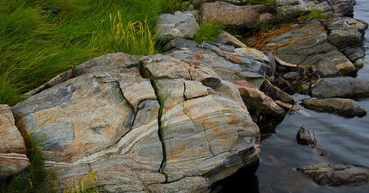
~1.5 billion year-old Belt basin rock atop 48 million year-old granite at Willow Lake on the West Plains near Four Lakes, WA.
The compelling science of the present, on an improbable pile of deep time
My siblings and I were not the kind of children you’d want to meet at the end of a long summer day. As often as not, we’d been crammed (there were six of us) into a Buick station wagon for hours on highways between Florida’s gulf coast (where my father’s parents retired) and eastern Washington. We elbowed for space, noisily petitioned for fast food and milkshakes, and pleaded for motels with swimming pools.
After a week of 400-mile days the Buick would reach the crest of the treeless, sun-baked ridge above Kennewick. From there we could see the blue ribbon of the Columbia River below and the warehouses of east Pasco, just a few blocks from where my mother was born and raised. It is so sparse and open it can ripple the mind, in the way that being afloat in mid-ocean can be disorienting for those new to the experience.
My first impressions of the lower Columbia Basin landscape have evolved over the years. The cataclysmic Ice Age flood story is fresh and visible if you’re alert to it. The late Pleistocene floods swept away whole tracts of dune-like Palouse hills and exposed 16 million year-old basalt bedrock, some of it in naturally-fluted columns like those we see in road cuts near Spokane’s airport or Sprague Lake, a half hour to the west, where the interstate is cut into the northern edge of an epic flood channel.
Washington’s lower Columbia basin isn’t Valhalla or the visual feast of the lakes, forests and peaks of the north Cascades. There’s a reason they offer free coffee at the rest stops. Because it’s reasonable to traverse the expanse between Spokane and Cle Elum before nodding off, it’s easy to whiz by the most interesting parts of the story without even knowing they’re here.
Along I-90, just west of Spokane, the highway follows a main channel of the Ice Age floods’ easternmost tract, where the floodwaters (also traveling at highway speed) blasted out a saddle between two buttes about 15,000 years ago. I’d long assumed the dark rock in the road cut through the saddle was basalt, just like the basalt in countless other road cuts in either direction. By chance one day, I just happened to notice a whitish streak—a small quartz vein perhaps—on the rock face. There are no quartz veins in basalt. That little epiphany stoked my curiosity, and that’s how I met geologist Chad Pritchard.
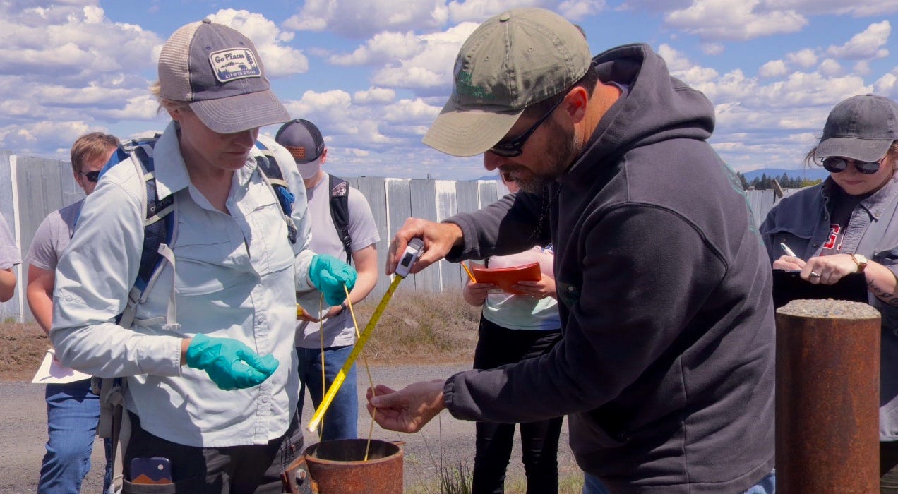
Chad Pritchard with EWU students at a groundwater monitoring well this spring near the Northern Quest casino just north of Airway Heights, WA.
Pritchard and his family live in the City of Medical Lake which, as the crow flies, is three miles west of the road cut through the saddle between Wrights Hill and Riddle Hill, the aforementioned buttes. His office at Eastern Washington University, in Cheney, is five miles to the east.
The back-hoe work in the saddle exemplifies why geologists really, really love road cuts. It’s how they get access to interesting rocks. Still, the rocks exposed at the highway are just a preview of what’s just down the hill. There, along the shoreline of Willow Lake, is a living museum of earth events stretching back to the Protozerioc epoch, long before the first dinosaurs appeared.
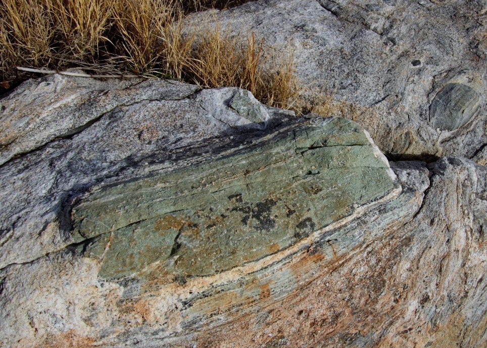
A bread-box sized, green gumdrop of Precambrian Belt rock encased in amphibolite (black grains) and granite at Willow Lake
Dubbed the “Willow Lake Aureole” by Pritchard and his colleagues the scene records a 48 million year-old collision between an upwelling of magma (now solidified as granite) and some of the oldest rock in the Pacific Northwest, notably a gray to pistachio-green rock from the Wallace/Piegan layers of the so-called Belt Supergroup. The Belt rocks took their form in an incredibly deep pile (more than 9 miles deep) of sedimentary rocks, nearly 1.5 billion years old. The Belt consortium extends northward into Canada where it is known as the Purcell Supergroup.
If you’ve visited Montana’s Glacier National Park, you’ve seen the Belt rocks, inasmuch as they form most of the spectacular peaks at Glacier, and, as cobbles, shine beneath the surface of Lake McDonald near the park’s western entrance.
I’ll just insert that it is mind-bending enough to look at a basalt outcrop near Othello, or Pullman, or downtown Spokane, and recognize the vulcanism of Hawaii. It’s quite another to see rock at Willow Lake that more properly belongs in Glacier or in the steep mountains of the Idaho Panhandle. At Willow Lake you can find melon-sized rocks that show the whole story: the 48 million year-old granite on one side of the rock, a corona of glistening, black amphibolite created during the extremely hot contact, and the much older, chalky green Belt rock forming the other side of the same heat-welded rock.
There is wonder in such surprises, in which the familiar gives way to the outlandish. It’s all the more rich when you can hold the evidence in your hands. Wonder has medicinal qualities. It can perk your interest and ignite your imagination.
Central Washington University’s Nick Zentner illustrating the Spokane area’s location on what would become the ancient North American (Laurentia) coastline as Australia separated and (apparently) took roughly half the Belt Basin with it, opening up an ocean.
This deep earth story doesn’t have to get any better, any more fascinating. But it does.
Rocks just to the west of Willow Lake are still much older than the basalt, yet hundreds of millions of years younger than the Belt rock. It begs the question: “what’s up with that?” which is the gist of what I asked Pritchard when I finally met him in his EWU office in November.
By then I knew half the answer, from Central Washington University’s Nick Zentner and casual tutorials from my friend Steve Box who has studied this part of the world as a geologist for the U.S. Geological Survey. Zentner playfully dubbed the Spokane area “John Stockton’s house” in a video broadcast from his back yard in Ellensburg four years ago. It’s become a running joke (Stockton is a basketball legend from Spokane), Zentner locates Stockton’s house on an ancient shoreline to make the point that—as the planet’s first mammal-like creatures walked on tiny feet—what are now Spokane zip codes were situated on the western edge of Laurentia (a.k.a. ancient North America) with abundant beachfront real estate. There are other visual representations of Spokane on the edge of Laurentia for hundreds of millions of years. Moreover, there is accruing evidence that the primeval coastline was at or near Medical Lake for millions of years as ancient North America moved about the globe, connected at times to what is now Australia, Antarctica and perhaps Siberia as well.
Nearly all of what is now Washington, Oregon and California consists of “exotic terranes”—land “accreted” to the continental shelf in the last 200 million years as the North American plate overrode successive oceanic plates. In short, the basalt and cataclysmic flood story I’d researched for my book Beautiful Wounds is juxtaposed with a much older and equally fascinating story that elbows its way to the surface in places you wouldn’t expect.
Pritchard discussing PFAS and the “fate and transport” study at a public meeting in Airway Heights earlier this year.
It was this astonishing deep time story—so close to home—that I went to talk to professor Pritchard about when I first met him, in person, in his office in the fall of 2022. What I didn’t know, then, is he was already deeply engaged in an emerging problem of the Holocene: the now. He was, and is, trying to get a handle on the distribution and movement of a fiendish regiment of modern synthetic chemicals—known as PFAS.
PFAS is an abbreviation for Per-and Polyfluoroalkyl Substances—long-chain molecules in which flourine atoms are manipulated to bond with carbon. PFAS containing compounds-of which there are thousands—have demonstrable and valuable applications. Yet, they are also highly toxic and extremely persistent in the environment. Hence their nickname as “forever chemicals.”
PFAS were discovered in the 1930s but didn’t become widely used until a 27 year-old DuPont scientist, Roy Plunkett, accidentally invented Teflon— the now famous non-stick substance eventually applied to millions of frying pans—as he was working to develop a new refrigerant. In addition to Teflon, PFAS were and are still widely used in a variety of industrial applications and consumer products. One of their most widespread uses has been in fire-fighting foams used to extinguish flammable liquid (i.e. aviation fuel) fires. Regrettably—even though Washington is one of several states to pass laws to phase out the use of PFAS in fire-fighting foams—their previous, widespread use has already contaminated water supplies in several communities near military and commercial airports.
The so-called West Plains of Spokane County, where Pritchard lives and where he’s studied the earthscape for much of his career, is one of those places.
In 2017, officials at Fairchild Air Force Base (FAFB) disclosed PFAS had been detected in groundwater samples collected at the base. Additional testing revealed contaminated groundwater had migrated northeast of the base perimeter, contaminating three groundwater wells used by the City of Airway Heights to provide water for its 10,000+ residents. The tainted groundwater at Airway Heights was quickly replaced with clean water piped in from the City of Spokane.
Suffice to say the human renal system has not evolved (at least not yet) to efficiently dispose of PFAS, which means it gets stashed away in the liver and remains in the bloodstream for relatively long periods of time. When the federal Agency for Toxic Substances and Disease Registry conducted blood testing of more than 300 Airway Heights residents in 2019, it found alarmingly high levels of PFAS, including one variant (PFHxS) that was more than fifty times higher than the baseline national average.
The contaminated groundwater wasn’t confined to the Airway Heights wells near the base. Subsequent testing has identified more than 300 private wells contaminated with PFAS at levels exceeding state and federal drinking water standards. The most recent testing implicates a second source—the Spokane International Airport—which was served with an enforcement order last year after state officials were alerted to groundwater test results showing high levels of PFAS in SIA wells. To say it is a thorny public health and political problem puts it mildly.
Given the revelations of PFAS contamination at other military and civilian airports it’s puzzling how unprepared local officials were for the disclosures of PFAS contamination originating at Fairchild and the nearby international airport.
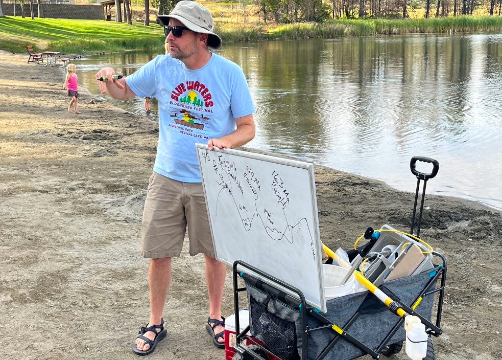
Pritchard with his white board and sampling cart on the south shore of Medical Lake in late August.
Today’s post is free but please consider supporting The Daily Rhubarb with a paid subscription at the link below…
Chad Pritchard wasn’t surprised. Shortly, after the presence of PFAS was confirmed he began working on the problem, co-authoring a technical paper in early 2019 that underscored the challenges of addressing the PFAS contamination before it further contaminated drinking water wells on the West Plains []. He began looking for additional funding to further the research and ultimately landed a state grant to lead a “West Plains PFAS Fate and Transport” study he expects to complete next spring. (I’ve reported on the resistance Pritchard and others faced at the county level in trying to initiate the study for fear it would implicate Spokane International Airport as a significant source of PFAS in groundwater. You can follow that part of the story here, and here.
Not that Pritchard complains about it (he has an effusive, positive attitude about his science and his teaching) but solving the puzzles of West Plains groundwater is no easy task. For starters, the groundwater flows on the West Plains are considerably more complex than those of the Spokane Valley-Rathdrum Prairie aquifer that provides water to nearly 800,000 people between Coeur d’Alene, ID and the City of Spokane.
The Spokane aquifer resides in a deep, 60 mile-long channel carved by catastrophic floodwaters (~15,000 years ago) from glacial Lake Missoula. The inland tsunamis that excavated the channel also filled the long and deep trough with boulders, cobbles and gravel. Consequently, groundwater flow rates through the Spokane aquifer are unusually high— more than 50 feet per day, in some places.
The West Plains aquifer Pritchard has studied for several years lives in a much different geologic neighborhood, one dominated by thick basalt layers left behind by the two largest lava flows (the Grande Ronde and the Wanapum, (~15 to 16.5 million years ago) of what is now known as the Columbia River Basalt Group (CRBG). There is groundwater within the basalt layers that moves through fractures and joints in the rock, and more swiftly in porous interlayers between the basalt layers. This is the basic hydrogeology of the CRBG, that fills the lower Columbia basin like a massive layer cake.
There are a couple important differences though.
1) As Pritchard likes to remind people, the West Plains are also home to some of the westernmost nubs of the Rocky Mountains. The Belt rock on display at Willow Lake is part of that phenomenon, as are prominent “steptoes”—a handful of buttes cloaked with Palouse-soil “loess” but with cores of billion-year-old metamorphic rock that align east to west south of U.S. Highway 2. Whereas groundwater flow in the CRBG generally heads toward the deep, basalt-filled Pasco basin south of Interstate-90, the West Plains steptoes shove groundwater in the opposite direction, to the northeast.. One of the early findings of the “fate and transport” study is that spring water emerging into creeks north and east of Spokane International Airport is contaminated with PFAS at levels well in excess of federal drinking water standards.
2) As Pritchard and his co-authors emphasized in their 2019 paper, the West Plains absorbed an incredibly forceful punch from the Lake Missoula floodwaters—so powerful that the overflowing waters essentially formed liquid tornados (the geologists call them “kolks”) swirling with debris that drilled hundreds of feet into the basalt layers. Those cavities were naturally filled in with gravel and other porous debris which, when saturated, allows groundwater to move 100 times faster that it does in the adjacent basalt. There are five of these so-called “paleochannels” on the West Plains. Two of the larger ones—the Airway Heights and Airport paleochannels—are considered major PFAS pathways, not only moving contamination laterally but vertically as well, thus allowing cross-contamination between water bearing strata.
There’s no sugar-coating the PFAS story on the West Plains. The hazard is real and pernicious and has implications for public health and property values. In an environment and time when almost everybody involved has been playing catch-up (or cover-up) Pritchard has been an invaluable presence, not just with his science but with his engaging personality and focus. (In addition to his geology and teaching, Pritchard is a member of the Medical Lake city council. Last week he was added to the Restoration Advisory Board for Fairchild Air Force Base as part of a new effort by the Air Force to enhance the RAB’s expertise and outreach efforts.)
I was trying to connect with him a few days ago when an opportunity arose to intercept him in person. I quickly grabbed my pens and cameras and drove out to Medical Lake where, he’d told me, he was about to grab some water samples.
When I got to a park at the south end of the lake I found him in the middle of a crowd of thirty or so people—community volunteers with trash-snatching claws who’d be gathering litter as they walked the circumference of the lake. To sweeten the invitation, Pritchard had promised a West Plains geology lecture, including the deep time story and the Pleistocene floods. He was pulling a wagon that held both his white board for the lecture and his sampling equipment, including a long, yellow “PFAS” pole to grab lake water samples beyond the shoreline.
This is just how he rolls these days.
—tjc


