Sunday's postcard, an underwater cyclone, and an ancient, extinct sea creature on the West Plains
June 18, 2023
Interstellar, 20”x30” aluminum print
Part I: A Submarine Tornado
When we last visited, Chad Pritchard opened his laptop computer on a table at the Roam Coffee House in Medical Lake. He was about to show me a complicated puzzle. It’s a proximate, local puzzle; one we’d be sitting upon were it not for the coffee shop floor beneath us.
Pritchard chairs the Eastern Washington University Geosciences department. He’s a prolific researcher and writer, including his co-authorship of Washington Rocks! a popular guide to 57 of state’s geological landmarks. Medical Lake is near the center of the West Plains and only a few miles from Fairchild Air Force Base and Spokane International Airport. For Pritchard—who also serves on the Medical Lake city council—it is home turf so to speak. He has studied the earth beneath the generally flat terrain out here as much as anybody. It packs surprises that are invisible from above.
Take water, for example.
You wouldn’t know it from a window seat of a passenger jet on final approach to Spokane’s airport but the water issues on the plains below are much more of a headache than in the adjacent City of Spokane.
The Spokane-Rathdrum Prairie Aquifer that Spokane easily taps into is one of the most beneficent sources of fresh water in the inland west. It is a massive trough filled with saturated cobbles and boulders that brings groundwater from the southern end of Lake Pend Oreille to the Spokane River gorge up to and including west Spokane. For an inland city that typically receives less than 24 inches of precipitation annually, this natural aqueduct is a gift for Spokane. But the aquifer abruptly ends just south of the river gorge. This wonder of hydrogeology does not reach the West Plains.
Compared to Spokane, the plains are high and dry. Although Medical Lake is named after one of several fairly large lakes in the area, the visible surface waters aren’t a symptom of abundant groundwater. As a general rule, the plains are perched on a high table of lava rock (basalt) that is generally 750 feet thick—much thicker than the height of Seattle’s Space Needle. It is common for well drillers to bore down 300 feet or more to reach the typically thin aquifers in the seams between the underlying basalt layers.
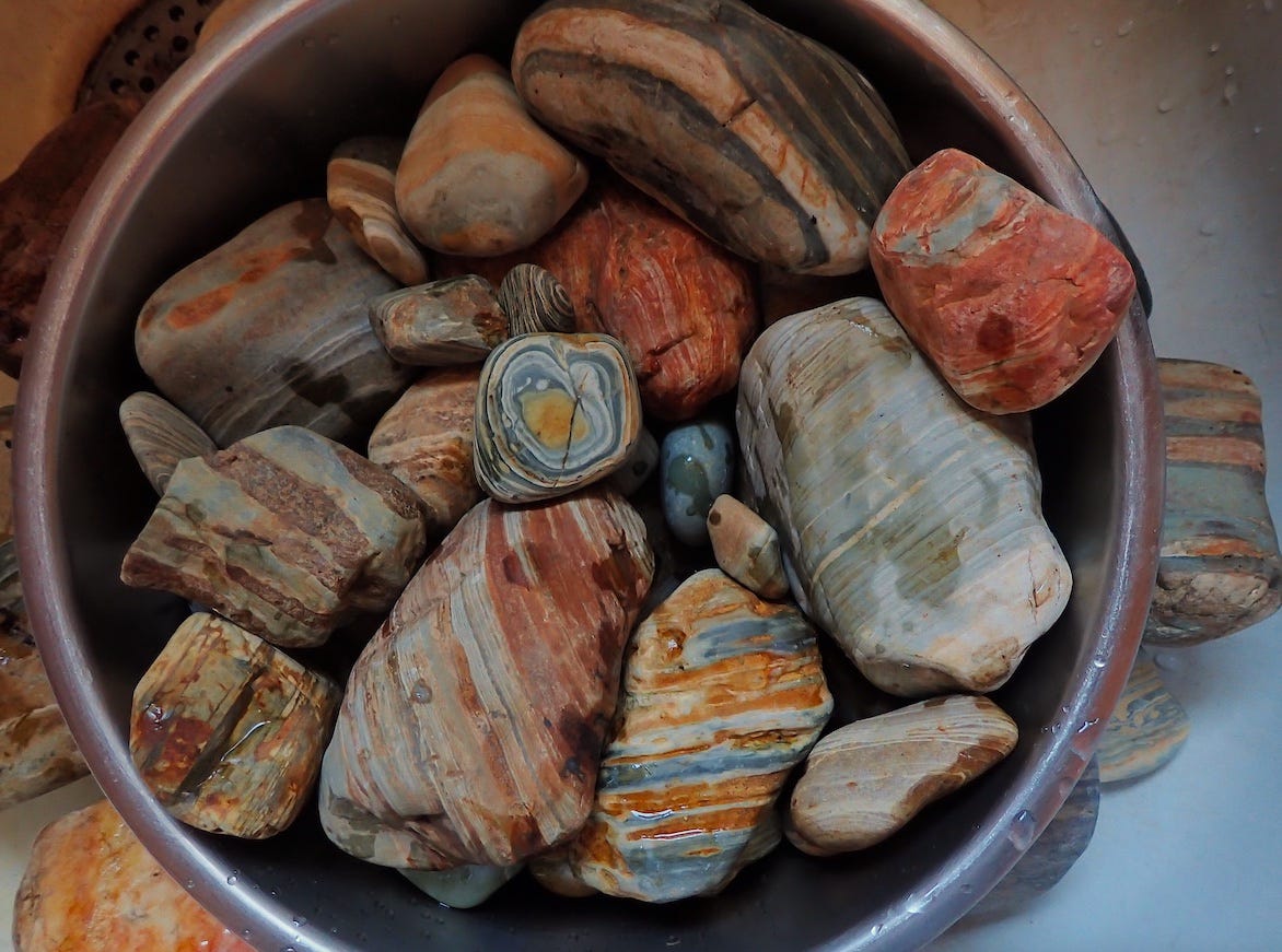
That’s just the general rule though. At our table at Roam Coffee, part of what Pritchard wanted to illustrate with help from his laptop are what he and other geologists call “paleochannels.” It is a fairly new term for me. I basically understood it to be a result of what happened 17,000 years ago when the epic Ice Age floods smashed into and through the basalt. The basalt got hammered—with whole sections simply blasted away. The overwhelming floods carried a massive load of rocks from the mountains of Idaho and Montana. Billions of cobbles filled in the broad cavities the floods carved into the basalt. The thick veins of cobbles thus created a path for groundwater that is much more “transmissive” than it would be through basalt.
Bucket of Ice Age flood cobbles from the Belt Basin
“Five hundred times faster,” says Pritchard.
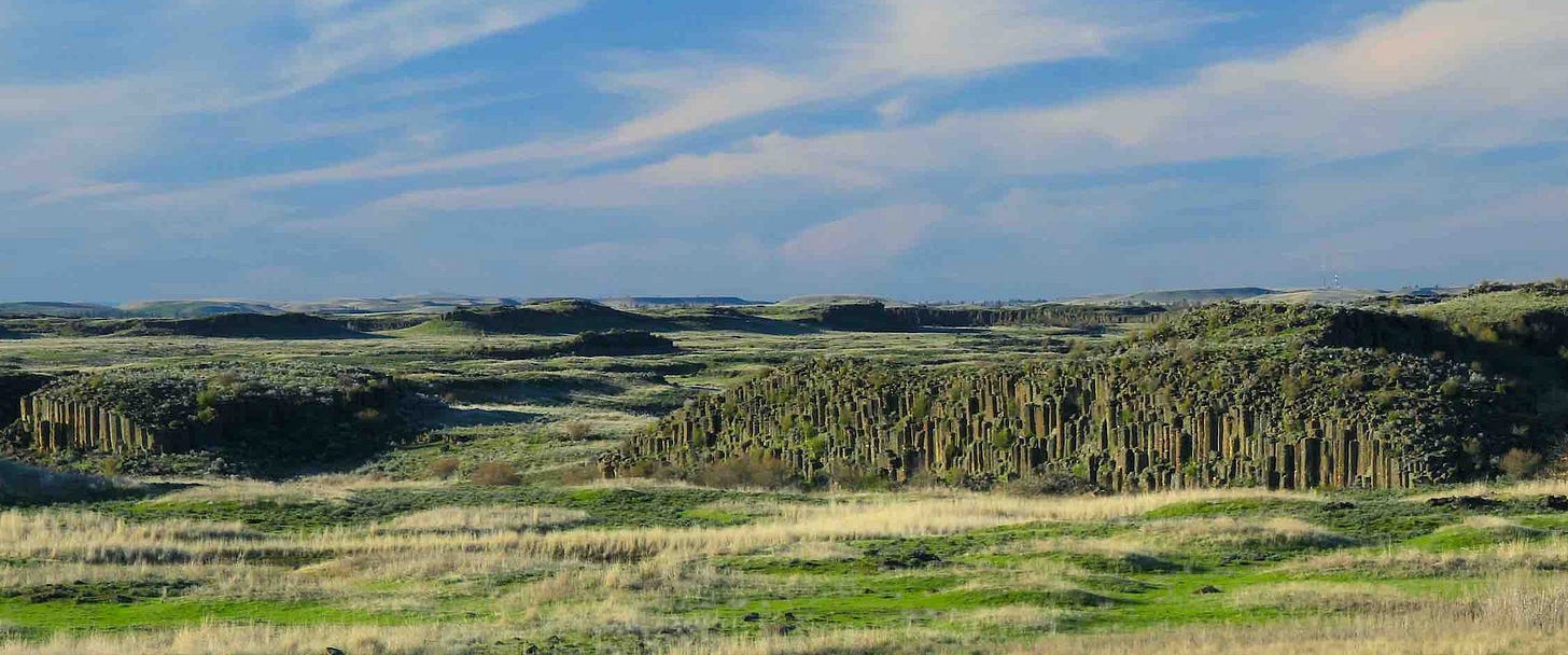
Based on what I’d seen in the channeled scablands some twenty miles further south (see photo below) I assumed the “paleochannels” were perhaps forty feet deep. I was way off.
The flood battered landscape, twenty miles south of the West Plains.
What I hadn’t accounted for is a phenomenon Pritchard was guiding me toward. On the West Plains the attack of the floodwaters—swirling as an icy slurry of water and rock—created self-enhancing effects, not just plunge pools but vortices within those pools that quickly escalated into massive, hydraulic drills. Similar effects have been documented in other places in the channeled scablands—pothole cavities in the basalt bedrock, drilled by floodwater vortices. The work of submarine tornados. But the result on the West Plains is jaw-dropping in scale. In one of the channels, the hydraulic drills ripped right through the entire depth of the Wanapum basalt and deeply into the underlying Grande Ronde basalt. Part of what Pritchard was trying to educate me about is that the extraordinary depth (over 600 feet) of a paleochannel near the Spokane airport. It is so deep it created a conduit for mixing of the Wanapum and Grande Ronde groundwater, an effect enhanced by contemporary groundwater pumping.
That effect has real-time consequences in the present sense, which is a subject I’ll get to in future reporting. In the meantime, I didn’t want to rush past the wonder of learning something that is (at least for me) truly head-spinning—the image of an underwater cyclone drilling a massive hole in the earth not far from where I live.
Part II: A Trilobite on the Edge of Time
Finding myself gobsmacked when learning about inland Northwest geology has happened before. A few months ago, I pitched an idea to The Inlander that evolved into an April 6th cover story, “Beneath our Feet.” The piece highlighted a half dozen places in eastern Washington that hold dramatic earth stories one can see and touch.
One of the stories—the oldest of the lot—is set at Willow Lake, one of the smaller lakes on the West Plains. I’d been driving past it for decades. It’s within sight from Interstate-90, just to the west of the Four Lakes exit where the highway passes through a broad notch created by the ice age floodwaters. It is just a few miles from where the raging floods drilled and carved the deep paleochannels on the West Plains.
It finally dawned on me one day that the dark rock in the road cut above Willow Lake is not basalt. It has unbasalt-like streaks in it. But it isn’t 15 million-year-old lava. Rather, it is the 1.4 billion year-old rock of the Wallace Formation, part of the very ancient Belt Basin that extends well into Montana. After forming deep in the crust, the Belt rocks were pushed to the surface, forming the highest peaks at Glacier National Park. It won’t surprise you that I learned about the Wallace rocks at Willow Lake by reading a 2017 paper co-authored by Chad Pritchard and colleagues at EWU.
I was, by then, already familiar with the Wallace Formation. Months earlier I’d visited an outcrop of the Wallace on a ridge above the Clark Fork River. This is right where the Purcell Trench ice lobe had blocked the Clark Fork River, creating ancient Lake Missoula, the source for the floodwaters that roared through Spokane and created the so-called “channeled scablands” to the south and west.
But it was disorienting to find Wallace Rock west of Spokane because, at least in my mind, it is Idaho/Montana rock. So what was it doing out here, I wondered. The simple answer is it had been there all along, just buried beneath Palouse soils and a cover of basalt—both of which were blasted away by the dramatic floods. There are buttes on either side of Willow Lake—Wright’s Hill to the southeast, and Riddle Hill to the northwest—and both have cores of Belt Basin rock. The lake itself is rimmed on its south and east shores with beautiful slabs and swirls encompassing the Precambrian Belt rock, with brick-size lumps of Wallace encased in younger granite, like giant green raisins in a granite fruitcake.
Precambrian (1.4 billion years old) Wallace rock (greenish color) encased in a porridge of much younger granite at Willow Lake on the West Plains
As I reported in The Inlander piece, the ancient rock at Willow Lake is at or near the edge of a long ago coastline that, for hundreds of millions of years, was part of the west coast of the North American craton. The Wallace rock at and near Willow Lake dates back to that history—it is pretty much right on the edge of the then-young continent.
When I’d interviewed Pritchard in his EWU office last fall I’d paused to absorb what he was leading me to.
“Yes,” he said, with a playful grin, “so you can imagine seeing the waves of an ancient ocean lapping a shoreline near Medical Lake.”
That would be story enough. But there’s more to it.
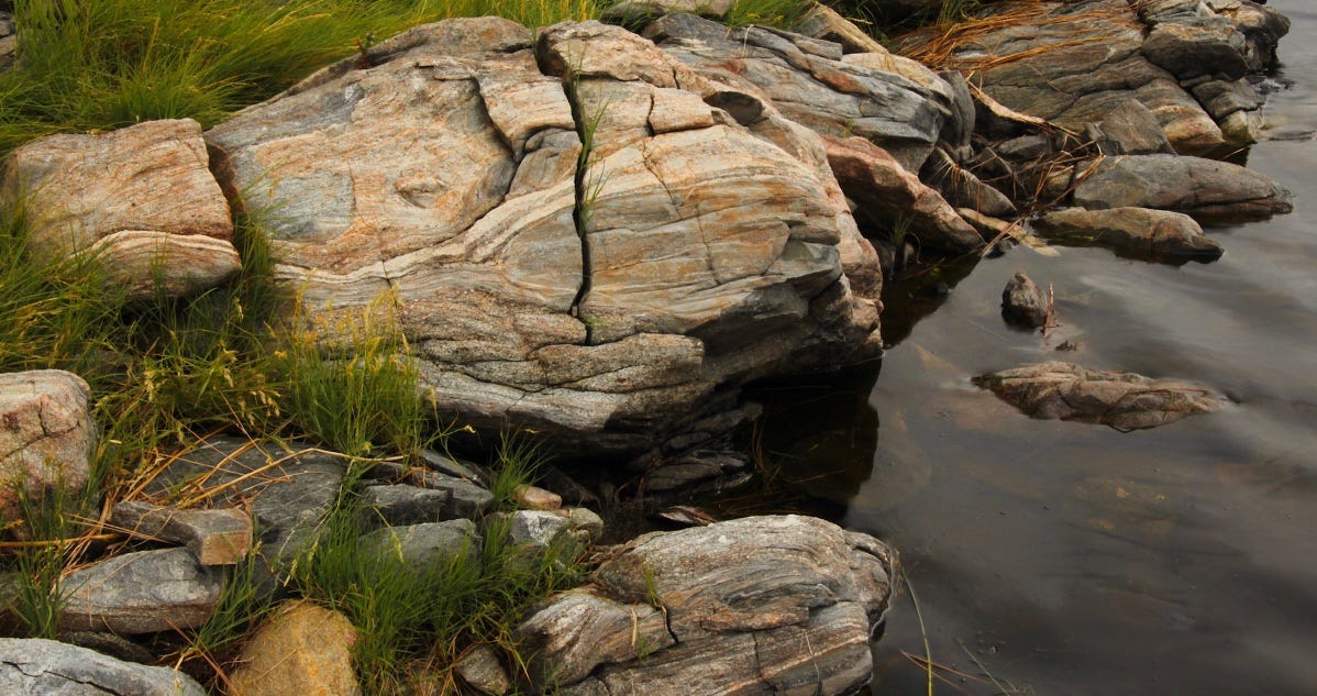
Wallace Formation rock along the Willow Lake shoreline
It turns out that Belt Basin rocks—especially those on the western side of the large, sedimentary basin—contain grains eroded from mountains in Australia and Antarctica. This is because the Belt Basin dates back to the age of the supercontinents Columbia (some call it Nuna) and Rodinia. Nearly a billion and a half years ago, mountains in North America (where the Rockies are now) were sending sediments into the basin from the east, while mountains in what is now Antarctica and Australia were delivering sediments into the basin from the west.
Illustration from April 2020 publication, “Between the Supercontinents” by Box, Pritchard et al, showing sedimentary pathways into the Belt/Purcell Basin from Australia and Antarctica 1.45 billion years ago.
Roughly 700 million years ago, the Belt Basin rifted (broke in half) as part of the break-up of Rodinia, and the evidence indicates the western half drifted away to become parts of Australia and Antarctica.
One of my geology mentors is Steve Box, a recently-retired U.S. Geological Survey scientist whose work has been instrumental in understanding the western boundary and sources of sediment into the Belt Basin before it rifted apart.
I was visiting with him on his back porch last September when he said something that confused me. He made passing reference to the recent discovery of a Cambrian epoch fossil on the West Plains near Four Lakes, which is only a mile northeast of Willow Lake, where the Precambrian Wallace rocks rest amidst swirls of summer dragonflies.
Fossils in Precambrian rock are negligible, at best, because so few life forms existed that early. By the Cambian epoch, however, the so-called “Cambrian explosion” (~540 million years ago) was underway and multi-cellular life forms were abundant.
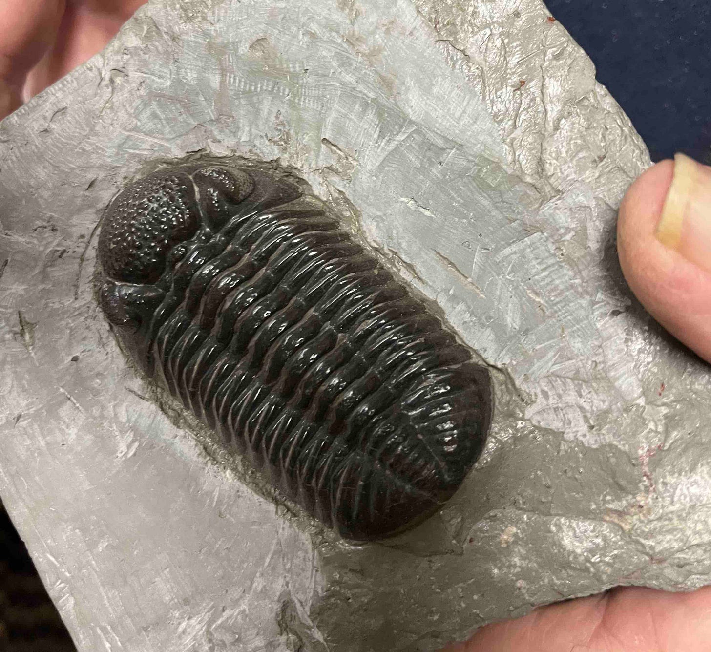
I was having a hard time getting my head around the juxtaposition. How could a Cambrian fossil exist so close to Precambrian rock? I put the question aside, but it came up again when I interviewed Pritchard in his office a few weeks later. The Cambrian fossil was found near Clear Lake, he told me. And it was a trilobite.
That really got my attention. I remember trilobites from elementary school—drawings in books and children’s magazines of the alien-like creatures swimming in crowded seas. Most were small, but some the size of skate boards. Cool.
What was even better is I recognized the geologist who’d written the description of the find and the finding near Clear Lake. It was Michael Hamilton, an amiable, well-respected Department of Natural Resources geologist known for his tutorials and connection to the Dishman Hills Conservancy where he is a board member.
I called him up and made an appointment to visit him. What I didn’t realize until I talked to him is that he wasn’t just the geologist who wrote up the discovery—he was the discoverer. Twenty years ago he was doing field work on a mapping project with two other geologists near Clear Lake on Air Force restricted property. A sewer line was being installed to a bathroom near the lake and the excavation of the line had turned up red shale. Hamilton says he was surprised to see the red shale, given how the shale “weathers pretty fast” and would be susceptible to erosion, especially in an area hammered by the ice age floods.
It was while inspecting the excavated red shale that he recognized the trilobite fossil and gathered it.
“The fact that it was there at all,” he says, “is somewhat of a geologic miracle.”
But it was there, and he grabbed it by the tail.
So how did the trilobite fossil get to Clear Lake? And why not Port Angeles, or Tacoma, or Yakima for that matter?
To date, only three trilobites have been found in Washington state. All have were found not just east of the Cascades, but east of Colville, within forty miles of the border with Idaho.
In short, the trilobite got to the shore at Clear Lake because—as Chad Pritchard reminded me—there had to be a new shoreline very close to Medical Lake when Rodinia rifted apart, pulling roughly half the Belt Basin away with it.
It would have been in that new ocean (think of it as a long ago preview of today’s Pacific) that the Cambrian trilobites lived their lives. Their skeletons would have been encased in ocean floor sediments and inexorably pushed to shore as an oceanic plate (a precursor of today’s Juan de Fuca plate) got shoved beneath the continent. In that process, the sea floor sediments holding the fossils would have been plastered onto the coast, as the plate itself was forced to dive beneath the continental plate.
Source: Washington Department of Natural Resources
This also answers the question of why no trilobites have been discovered further west than Addy, Washington. The first terrane to arrive at the coast—the Kootenay terrane —was like a door closing behind any Cambrian fossil (like the trilobite) that came ashore just ahead of it. The Kootenday terrain got added onto to the Rodinian edge of North America between 350 and 170 million years ago. A section of oceanic plate only lasts about 180 million years before it gets devoured by collision with other plates. Thus, all subsequent incoming terranes—in the train behind the Kootenay terrane—would have arrived at the coast long after the trilobites became extinct during the great Permian extinction, some 250 million years ago.
A complex story, for sure. But, yes, a trilobite on the West Plains. Wild but true.
—tjc


