My camera partner “Bruce” on a tripod at Upper Palouse Falls during the “Beautiful Wounds” book project
Before I start filling in some highlights I wish to thank all of you who wedged your way into Hamilton Studio Friday evening for The Preposterous Spokane Flood event. It’s not that the studio— an elegant re-incarnation of a gymnasium, with free-throw lines still on the floor—is small. It’s just that it was packed well beyond the 144 chairs on hand. It was a bit overwhelming but I’m so grateful to have seen so many old and new friends, some of whom had come a long distance. Words can’t describe how grateful I am to Don, and Lorna and TJ and Linny D for all the work the Hamilton studio family put into producing and hosting the event.
Map showing extent of the most recent glacial advance during the Wisconsinan period (~18,000 years ago)
My head can only hold so much information, and even the facts that stay between my ears will sometimes hide under the furniture when I call them forth during a talk. I bring lots of notes but it’s a challenge to read them without pausing and reaching for my reading glasses. That’s not a problem here…
Green Monarch Ridge in the distance, photographed near Hope, Idaho
This is one of the photos I used early in the evening to locate the Purcell Trench ice lobe that blocked the Clark Fork River ~17,000 years ago creating glacial Lake Missoula. The steep, snowy face in the center is on the west-facing side of Green Monarch Ridge. It is where the massive, southward-moving glacier pressed against the ridge, sealing the ancient ice dam-forcing glacial Lake Missoula to from to the east, filling the valleys of western Montana with ice water. A hundred and ninety miles to the southeast, the peak depth of the glacial lake at present-day Missoula was nearly 1,000 feet.
Today’s Lake Pend Oreille is the 8th largest lake in the U.S. by volume, holding 14 cubic miles of water. By comparison, glacial Lake Missoula contained approximately 500 cubic miles of water—35 times as much. And that begins to give you an idea of how Lake Missoula outbursts could overflow both the Spokane and Columbia River valleys to gouge out the scablands, including Grand Coulee and the stunning Palouse canyon between Hooper and Lyons Ferry.
Spokane viewed from Palisades Park, looking eastward in the direction from which the Lake Missoula floodwaters arrived
At what is now Spokane, the floodwaters would have reached a depth of 1,100 feet, nearly the height of two Seattle Space Needles (one atop the other) and four times the height of Spokane’s tallest building, the U.S. Bank Tower, that you can see in the shadows on the right side of the photograph, amid the cluster of other downtown buildings in the central core.
The camera is situated on a basalt ledge at Palisades Park, at 600 feet above the city below, on the eastern lip of the West Plains. Even here, there would have been another 550 feet of water above the camera. This is why the floodwaters left ripple marks and deep “paleo-channels” on the West Plains as the inland tsunami ripped through, at freeway speed, on its way toward the Pasco Basin.
Rowena highlands in the Columbia Gorge, looking east.
This is a photograph from the Rowena highlands, a few miles east of The Dalles, on the Oregon side of the Columbia River gorge. A day or so after each obliteration of the ice dam holding back glacial Lake Missoula the floodwaters would pool in the Pasco Basin (the ephemeral Lake Lewis) behind the constriction at Wallula Gap, where the Columbia has to shoulder through the basalt ridge of the Horse Heaven Hills. The waters would regain speed after squeezing through Wallula Gap and making the hair-pin turn toward the Pacific, creating yet more scablands in the gorge, all the way to the ocean. You can plainly see this both in the foreground and distance in this photo taken nearly 700 feet above the Columbia, looking east.
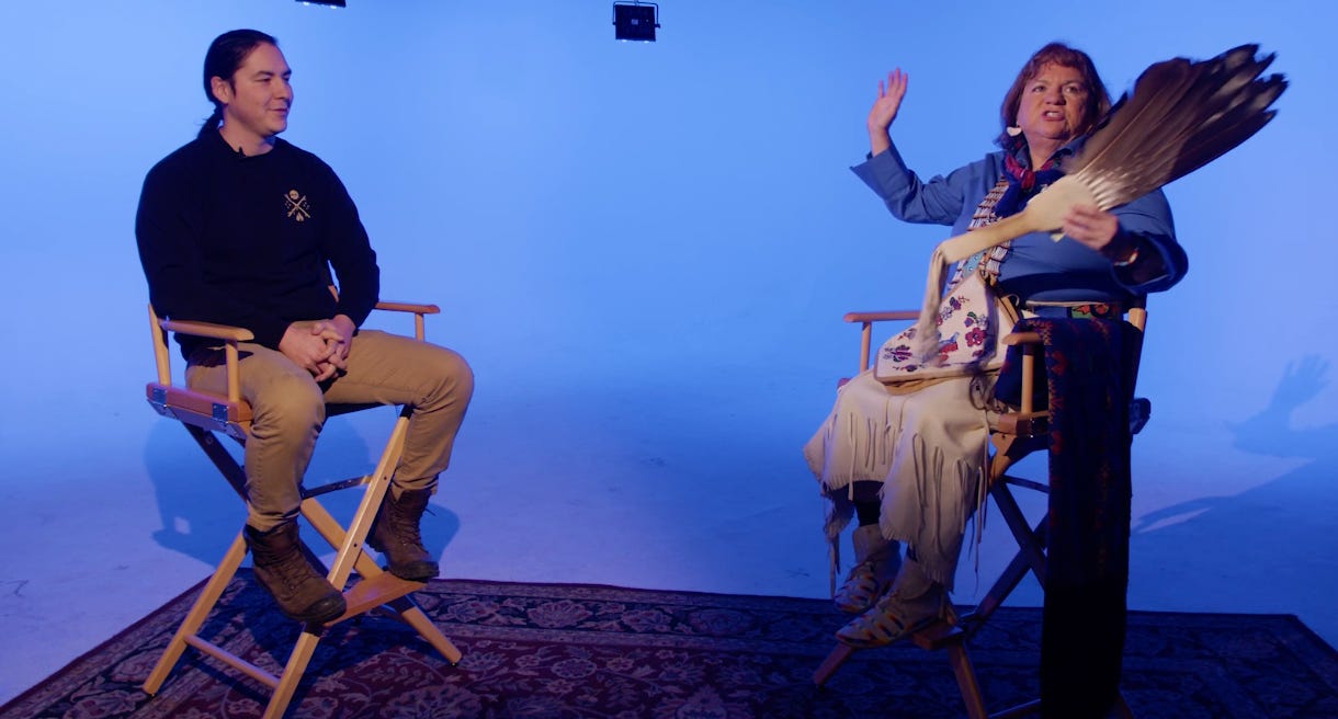
Craig & Margo Hill, sharing the Spokane’s great flood story and the regeneration of the Spokane tribe.
The most satisfying part of The Preposterous Spokane Flood evening came right at the end, where I could stop talking and simply enjoy Margo Hill and her son Craig tell (in Spokane Salish, translated to English by Craig) the Spokane’s great flood story. The first part is tragic—how the flood decimated the native people along its fast-moving front of destruction. But the second part of the story is the rich, creation story of the survivors whose progeny became the Spokanes of today.
The geo-science that J Harlen Bretz and his successors brought to the “Spokane Flood” story is fascinating and often stunningly precise. It anchors our understanding of what we see and what is underfoot.
But the fuller experience, of becoming a living, ephemeral part of the present (to walk, see, smell, listen) is the journey I was trying to describe in Beautiful Wounds, with words and photography. I’m used to choosing my assignments, but this one was chosen for me and came without a deadline.
—tjc


